Assessment: Know the Conditions.
Know where each asset stands and the projected needs of your entire portfolio at a glance. It’s complete and consistent visibility without increased workload.
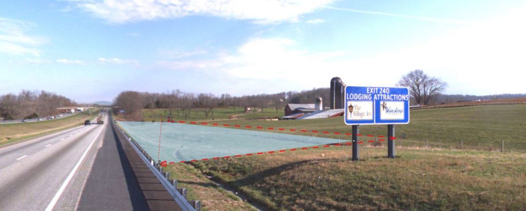
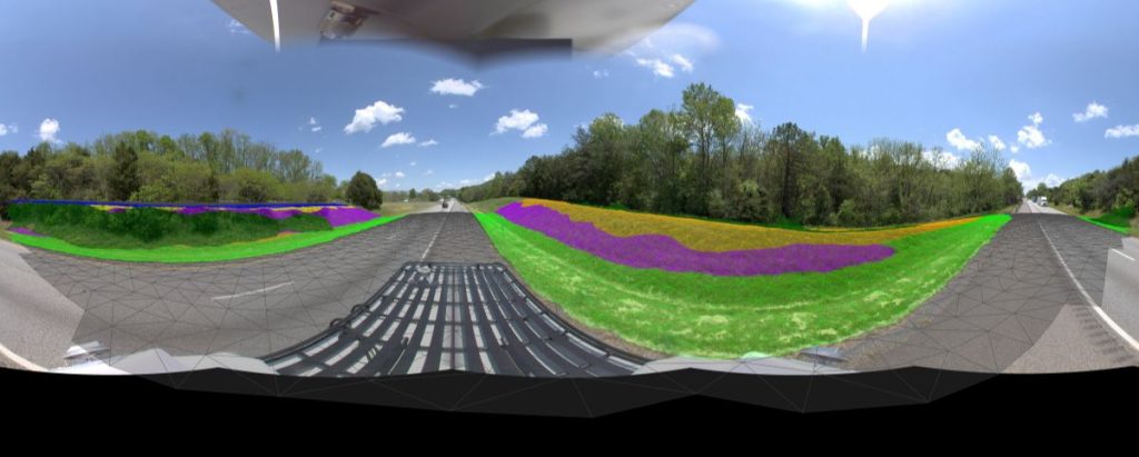
Imagery Analysis: Pinpoint Condition with Precision.
Leverage machine learning to turn raw photos into usable information—without manual inspection. We harness the power of machine learning to analyze your photos and capture asset conditions fast. Then we deliver results in an organized, searchable, and mapped format so insights are easy to find and use.
Don’t waste time combing through a massive image collection. Our technology can deliver consistent data across districts, routes, and time periods. All without increasing workload.
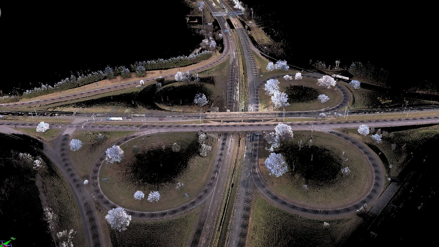
Point Cloud Analysis: Evaluate Conditions from Anywhere.
Survey-grade, 3D roadway measurements at scale. All without the time, cost, or risk of traditional field surveys. That’s what you get with PILLAR’s point cloud analysis. We leverage the point cloud of your data to form a precise, digital model of conditions on the ground including:
- Distances
- Heights
- Clearances
- Geometry
Limit fieldwork and make better decisions with a meticulous, 3D understanding of your network.
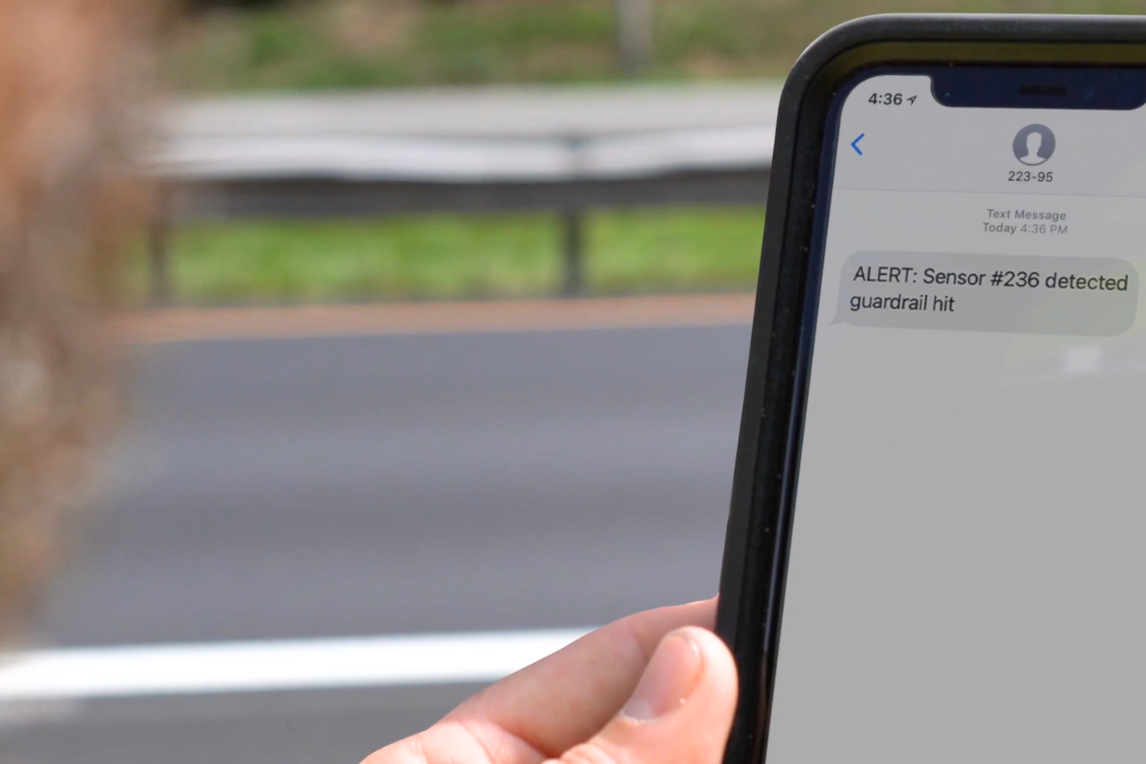
Connected Infrastructure: Instant Alerts Across Teams.
Eliminate silos with connected infrastructure. PILLAR uses the Internet of Things and sensor technology to send live alerts from the field to your entire team. In real time. Empower your team with current information in a single platform for faster, more coordinated decisions.
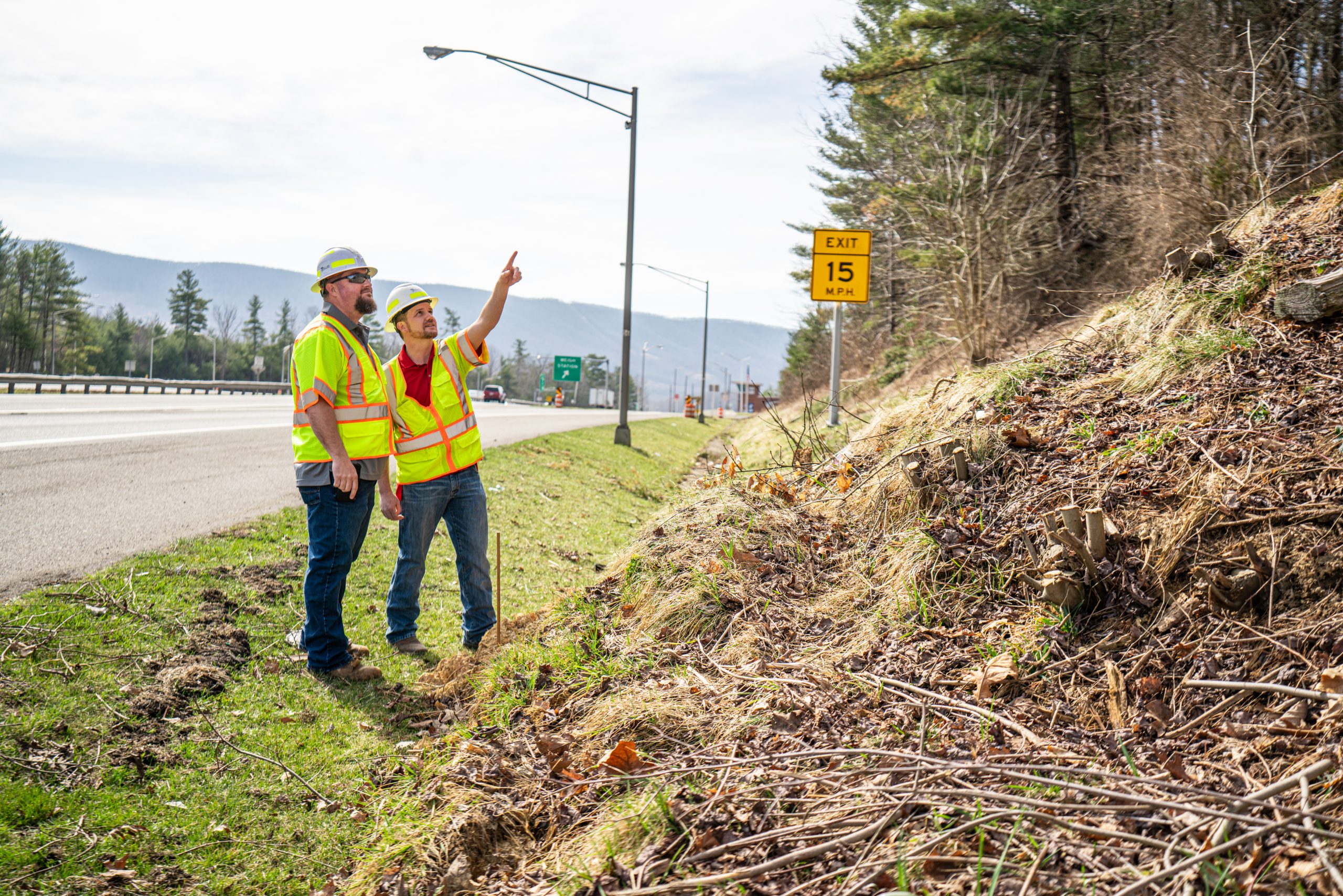
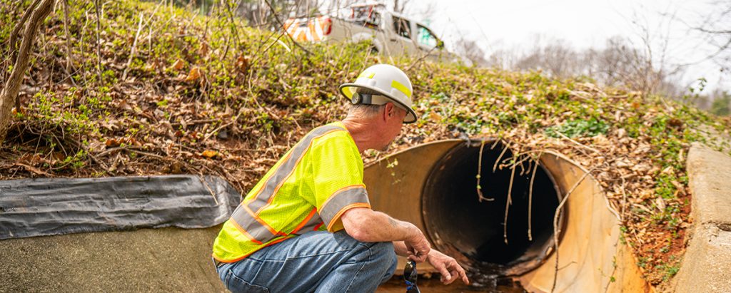
Field Assessments: Safe. Fast. Expert.
Sometimes nothing can surpass a physical inspection for getting specific data. That’s why we offer boots-on-the-ground assessment from specialized assessment professionals. Rather than deploying an entire crew, our pros can go right to the problem to gather field-level detail. You’ll get a consistent rating integrated into your existing systems. It’s fast, accurate, and reliable.